
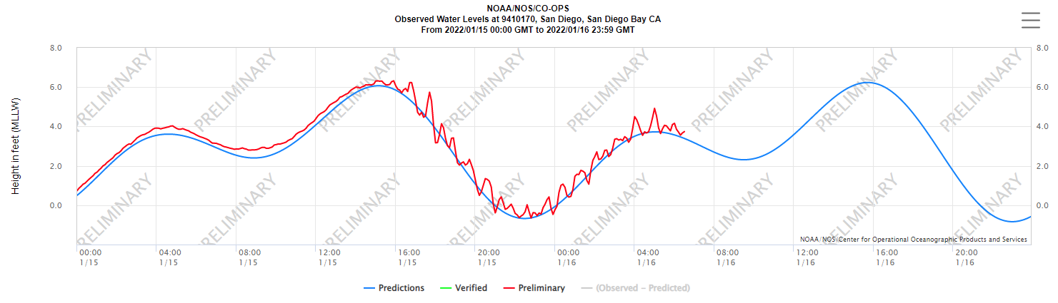
Coronado residents received an emergency tsunami advisory starting at 7:50 am Saturday January 15, 2022 indicating a series of waves with strong currents were expected for several hours. Everyone along the Western coast of the United States and Alaska was advised to move off the beach and out of the harbors and marinas as waves were forecasted at a height of 1 to 3 feet above normal.
The National Weather Service (NWS) reported Saturday’s peak waves in San Diego were 1.4 feet at 12:32pm before cancelling the advisory at 1:30pm when wave heights diminished.
Coronado residents observed minimal tsunami effects along the coastline.
A tsunami is a series of waves of near or distant origin which results from large earthquakes, underwater landslides, or volcanic eruptions. The January 15, 2022 tsunami was triggered by an underwater volcano in Tonga located over 5,000 miles across the Pacific Ocean from San Diego. Fortunately, Coronado and Southern California are at lower risk of large tsunami waves from distant events thanks to a combination of the deep, rugged seafloor and the coastal Coronado Islands that act as a buffer for large waves approaching the coast.
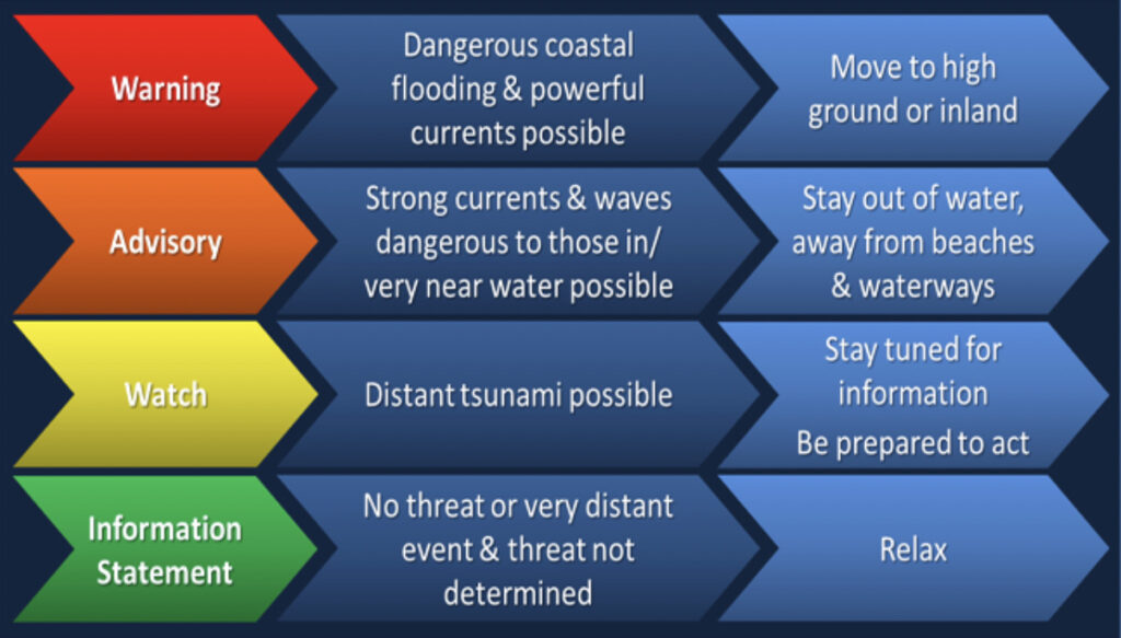
The NWS alert system has four levels for classifying tsunami risks:
- Warning: most severe with waves up to 4 feet. Evacuation recommended.
- Advisory: less severe with waves up to 3 feet. Stay away from the beach and water.
- Watch: least severe. No action required.
- Information: no risk or action required.
Over the last 100 years, the San Diego area has experienced 11 tsunamis that were mostly caused by earthquakes in Japan, Chile, or Alaska. In the early 1800s, local earthquakes caused tsunamis in San Diego with 6 to 8 foot waves. However, geologists have stated a local earthquake of 7.0 or larger magnitude today would likely lead to 4 foot waves with potential damage to boats or waterfront property .
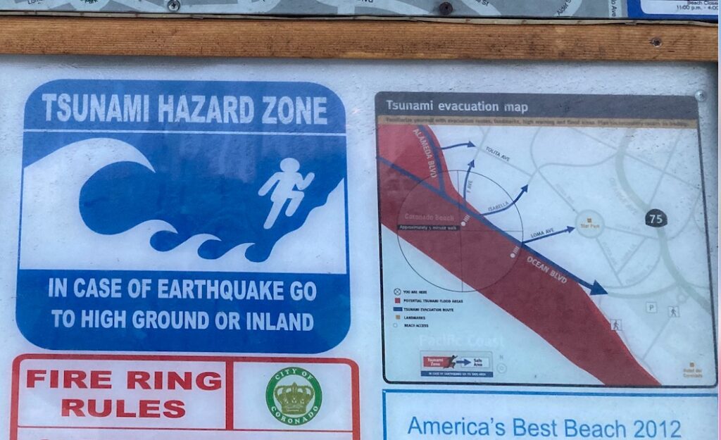
In 2012, Coronado earned the TsunamiReady designation by the National Weather Service indicating the city had developed plans to prepare and warn residents about tsunamis. Coronado’s TsunamiReady plan includes:
- Installing Tsunami hazard zone signs at several locations around Coronado including the entrance to Central Beach and the beach behind Silver Strand Elementary.
- Mapping potential Tsunami flood areas
- Designating evacuation routes
- Developing an emergency notification system that includes telephone calls and emergency sirens
- Identifying potential emergency shelter locations
- Developing an educational brochure to be distributed to residents and online

The most recent emergency alert is a reminder to Coronado residents to be aware of the different tsunami risk levels and potential flood areas as well as their recommended evacuation route.
RELATED:
Tsunami & Strong Current Advisory Due to Tonga Volcanic Eruption
RELATED:
Why the Volcanic Eruption in Tonga Was So Violent, and What to Expect Next

