Another in a regular series of fascinating, intriguing, or thoughtful tales about people and places in Nado history — presented by your Coronado Historical Association
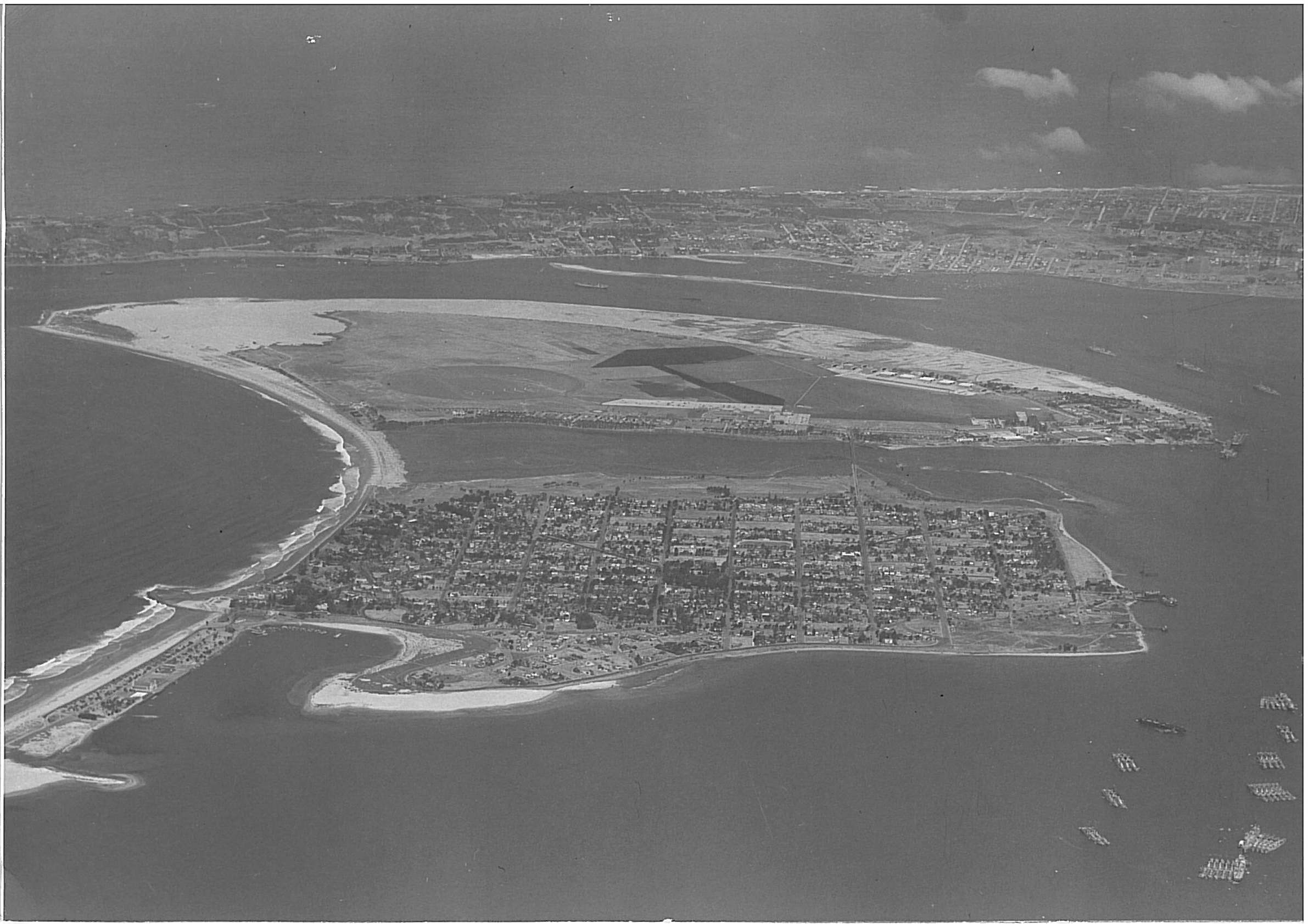
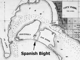
Spanish Bight lay between Coronado and North Island. It was naturally formed, the result of tidal and current conditions within San Diego Bay that deposited silt and sand from several local rivers. Spanish Bight has been a part of Coronado and San Diego history since the very first diaries and deeds were recorded in the early nineteenth century.
A “bight” is a body of water bounded by a bend or curve in the shoreline. Spanish Bight ran roughly north-south between the ocean and San Diego Bay, and measured approximately 1780 yards long and 190 yards at its widest point. Spanish Bight ran almost all the way from San Diego Bay to the ocean, separated by a band of sand (barely 60 yards wide at high tide) connecting North Island with Coronado called “the sandpit” by locals.
Once North Island began being used for aviation experimentation in 1910, Spanish Bight began to attract a lot of attention. Aviation pioneer Glenn Curtiss flew the world’s first seaplane (then called a “hydroaeroplane”) from the calm waters of Spanish Bight on January 26, 1911. His other flights, used to convince the Navy to purchase his aircraft, all used Spanish Bight as a seaborne “runway.”
Although naturally formed, Spanish Bight was prone to silting and occasionally Coronado dredged the Bight for convenient sand to help shape the western boundary of the city. The Coronado Country Club, golf course and polo field each benefited from this fill sand and occupied what is now the Country Club residential area, with Spanish Bight just to the west.
As more activity blossomed on North Island, a causeway was built around 1914 to connect North Island to Coronado at 4th Street, with the city bounded on the west by Alameda Boulevard. The Army had replaced the Navy as the primary flying organization at North Island and the causeway was used for a lot of the construction materials needed to build their aerodrome.
With the advent of World War II, the Navy needed to expand their facilities at North Island, but were out of room. Aerial photos show that Spanish Bight was still in evidence in 1942 but was highly silted, especially along the piers of the causeway.
Accordingly, beginning in late 1943, the Navy began to fill in the Bight. They used material dredged from the bay, which turned out to have an excellent foundation of sand on which to build, but stories were rampant of also using “everything but the kitchen sink” to help fill in the Bight including beyond-repair aircraft.
Initially, the Navy built 22 structures on filled Bight land, including warehouses, barracks, and a mess hall, galley and recreation hall. A much-needed quay wall was built at the north end of the Bight to accommodate new, Essex-class aircraft carriers four of which could be moored along the quay at one time. (ER)
photos courtesy Coronado Historical Association