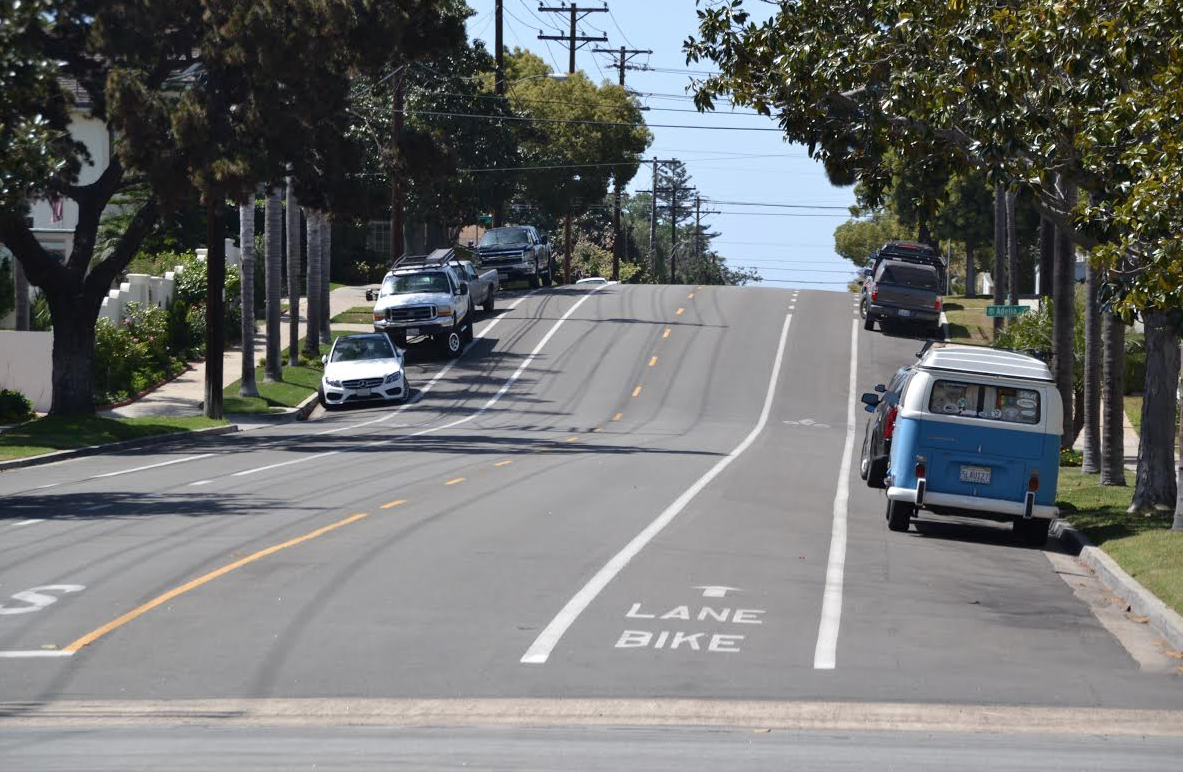
Pictured are the bicycle pavement markings on Glorietta Boulevard. Similar bike lanes would be painted on the 59 foot wide section of Alameda Boulevard and potentially on Olive Avenue as part of the integration of the City’s Bicycle Master Plan with its annual resealing of the streets.
At its February 3 meeting the City Council agreed to consider combining implementation of the Bicycle Master Plan with the periodic resealing of the city’s streets. If approved by the City Council the combined program will begin with the resealing of Alameda Boulevard, Second Street between Alameda and Orange Avenue, Tenth Street between Alameda and Orange Avenue, Fifth Street, I and J Avenues, Olive Avenue, Orange Avenue between First and Third Streets, Avenida Lunar, and Avenida del Sol.
In addition to applying a slurry seal to the roadways, which will fill small cracks, improve the skid resistance of the pavement, and stop raveling, which is the loss of the bond between the aggregate and the asphalt binder, the City Council will consider adding to the work marking the pavement in accordance with the Bicycle Master Plan. These markings would include Class 2 Bike Lanes along Alameda Boulevard and Tenth Street from Orange Avenue to Alameda Boulevard. In addition, either shared-lane markings, known as “sharrows,” or bike lanes would be added to Olive Avenue and the present front-in diagonal parking would be changed to back-in diagonal parking.
Back-in diagonal parking is similar to parallel parking, except without the need to straighten out into a parallel position after backing into a parking space. The angle of the parking stripes are re-aligned when changing from front-in to back-in diagonal parking to make it easier for drivers to back in. Advantages of back-in diagonal parking include allowing access to the trunk of a car from the sidewalk rather than the street and allowing car doors to open in a fashion that directs passengers toward the sidewalk rather than the street. Back-in diagonal parking is also supported by the National Center for Safe Routes to School.
Further, if supported by the community, the City Council will consider adding shared-lane markings on the street scheduled for maintenance that do not have markings recommended in the Bicycle Master Plan. Shared-lane markings or sharrows are symbols painted on the pavement that guide bicyclists to the best place to ride in the travel lane and alert drivers to the potential presence of cyclists and their possible location. The markings combine a white bicycle symbol with arrows in the direction of travel. The use of sharrows has been shown to help cyclists avoid colliding with open car doors, increase the distance between cyclists and passing cars, reduce the incidence of cyclists riding the wrong way, and reduce the incidence of cyclists riding on sidewalks. The streets that would receive sharrows are Fifth Street, Avenida Lunar, I and J Avenues, Second Street between Alameda and Orange Avenue, Avenida del Sol, and Orange Avenue between First and Third Streets.
To gather resident feedback on the proposal to incorporate the bicycle markings into the city’s street resealing program, the city staff developed an on-line survey. Over 1,300 informational letters were sent to the property owners and residents of the streets included in the 2015 street resealing project. As of the morning of April15, city engineer Jim Newton stated, “we had 121 responses to the survey which will remain open until April 21 when the item goes to the City Council. Due to our internal deadlines on staff reports the City Council’s report will include some of the initial feedback collected through the survey, but we plan on providing them with all other survey response information collected on the 21st.” Newton further stated that questions and comments can also be directed to the city’s active Transportation Planner, Mariah VanZeer at 619-522-2423.

Shown are the bike lanes on Sixth Street. Similar lanes would be painted on Tenth Street and the 48 foot wide portion of Alameda Boulevard.
The Bicycle Master Plan was adopted by the City Council in March 2011 and was subsequently incorporated into the city’s Master Plan. The bicycle plan consists of a system of Class 1 Bike Paths, Class 2 Bike Lanes, and Class 3 Bike Routes. A Class 1 Bike Path provides a completely separated right of way for the exclusive use of bicycles and pedestrians. Bike paths presently exist on the Silver Strand and under the bridge and along the bay side of Tidelands Park up to the Ferry Landing. Class 2 Bike Lanes provide a striped lane for one-way bike travel on a street and are located between the parking area and the traffic lanes. The Bicycle Master Plan includes a network of bike lanes throughout the city. Class 3 Bike Routes provide for the shared use of a roadway by bikes and motor vehicles. They are used where roadway speeds and traffic volumes are fairly low and there is an adequate shoulder. In addition to directional signage they can be delineated by shared-lane markings. The master plan identifies a number of streets for marking as Class 3 Bike Routes.
To date the city has implemented portions of the master plan. City staff changed the stop signs along the Silver Strand bike path to yield signs. Bike lanes were installed on Sixth Street using funds from a state Safe Routes to School grant administered by Caltrans. The project originally included similar markings on H Street, but the work was not pursued because of resident opposition. Bike lanes were marked on Glorietta Boulevard funded by a state Bicycle Transportation Account grant, also administered by Caltrans. This work was originally part of a larger project that included bike lanes and bike routes along a “scenic loop” around the city. However, the other portions of the project were not implemented, although funded, because of resident opposition.
—–
Related: Coronado Street Maintenance and Bicycle Markings Questionnaire
—–
John Tato
Staff Writer


