
The Port of San Diego is putting forth three long-term and nature-based solutions to reduce the ongoing erosion of the coastline at the Coronado Cays Grand Caribe Shoreline Park.
The Port’s project team introduced the design concepts at a public meeting Tuesday evening, whereafter members of the community were able to give their opinion on each of the potential solutions.
“Grand Caribe is a good candidate for a nature-based system,” said Brian Leslie, senior coastal scientist and project manager at GHD. “There’s space to work with and also there’s a sandy beach to work with. The state prefers them, so regulatory pathways are cleaner and faster and there’s grant funding to support them.”
The first concept proposed is an ecotone slope and cobble berm. Essentially, according to Leslie, it would mean flattening the beach scarp into a slope and placing cobbled berm at the toe. The cobble would then be buried and vegetated with native habitat, like coastal strand. 
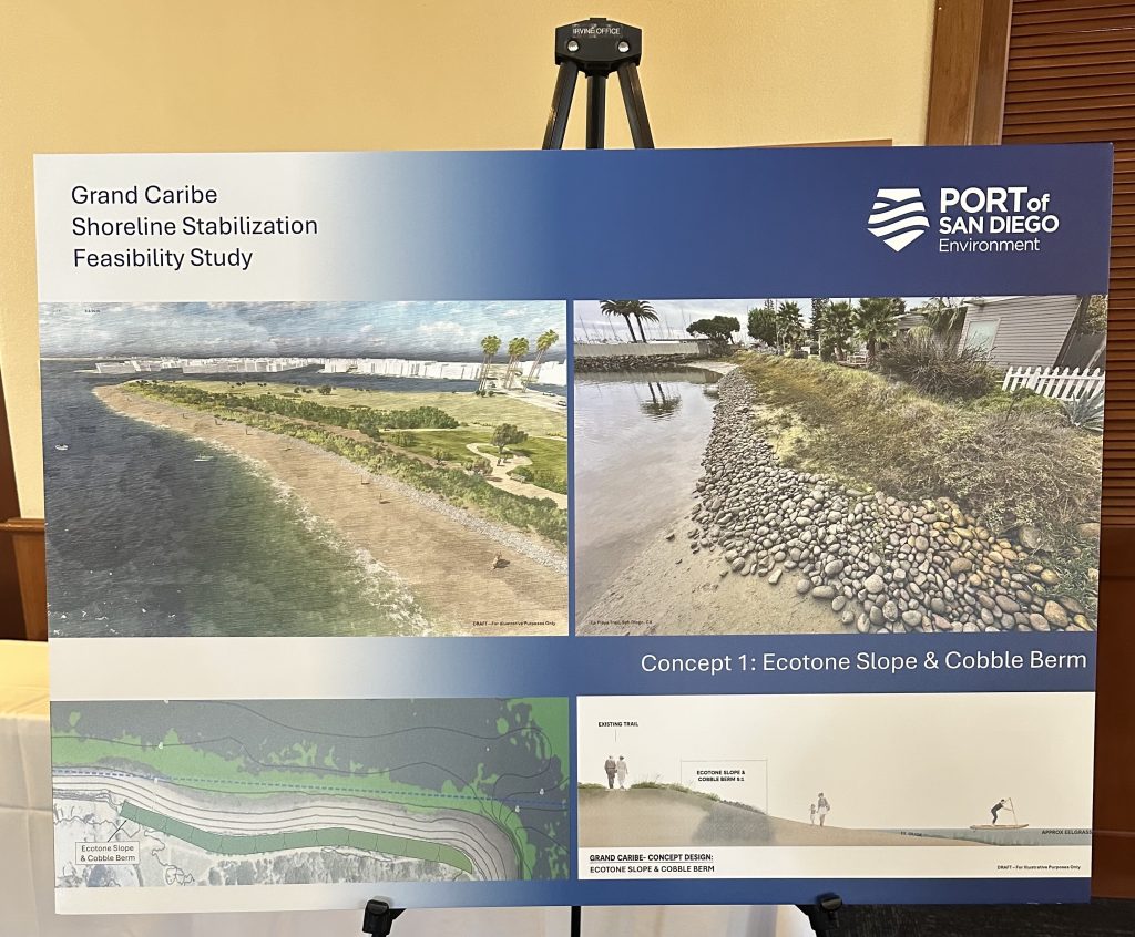
“Number one: stabilize the back beach and kind of like hold the line, if you will,” Leslie said, adding that one thing to note about this option is that it would not widen the recreational beach.
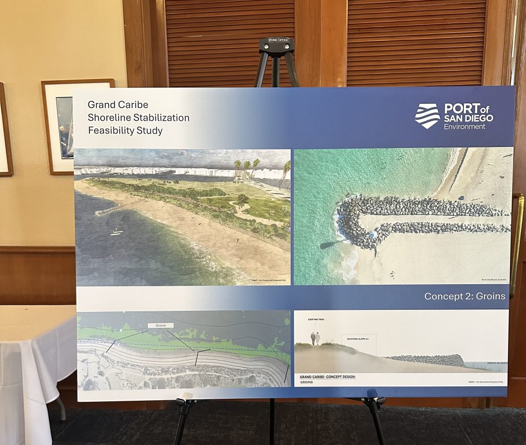
Concept two is using groins to hold the sand in place. Groins are shore perpendicular structures that are meant to slow or stop the longshore movement of sand. They can be built of different materials, including timber, sheet piles and cobbles, although rock is probably the most common, according to Leslie.
 The third option is using headlands, also known as detached breakwaters. Headlands are shore parallel structures and they’re meant to limit the sand moving in both the longshore and cross shore direction. According to Leslie, they are really good at holding a beach together and slightly better than groins, in most situations, to retain sand.
“[Headlands are] going to extend the beach life,” he said.
 Leslie also pointed out that options two and three would build out a recreational beach through placing sand.
Some residents, however, raised concerns about the project’s potential impact on the adjacent channel and the need for a comprehensive solution – one that includes the entire peninsula, not just one shoreline area.
“The channel is not a part of this project but … [it] is a component of the project,” said Timothy Barrett, a program manager from the Port of San Diego. “The intent of this project is to avoid any further sediment from transporting into the channel. If the project has any beach nourishment component of it, we would be acknowledging that we cannot be adversely impacting the channel.”
Barrett added that although dredging, the process of removing sediment from the bottom of water bodies, is not a part of this project, the intent of it is to avoid sending the transport further down.
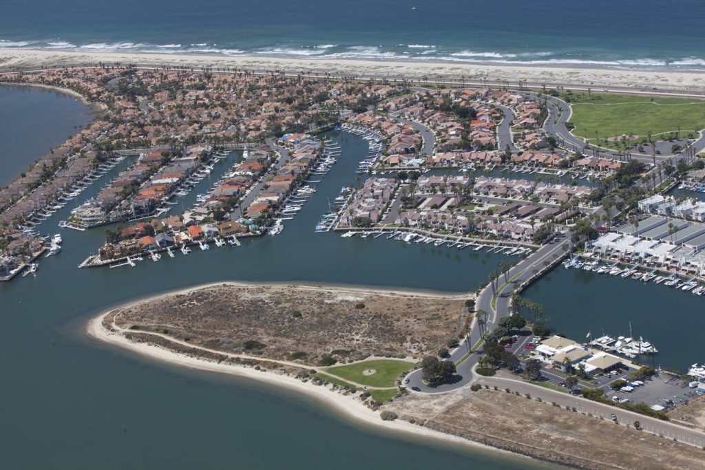
Grand Caribe Shoreline Park is located in the Coronado Cays neighborhood, on an artificial peninsula in the Southwestern San Diego Bay. It provides recreational public access to the coastline. But since its construction in the 1960s, its eastern shoreline has experienced chronic erosion.
To temporarily manage it, the Port has exhausted short-term solutions, including the placement of 240 burlap sandbags along the shoreline.
A coastal site assessment was completed in 2024 as the first step to come up with longer-term solutions.
Another public workshop is scheduled for early June based on community feedback from the first meeting. The Port will then refine the final concept and develop engineering design drawings for implementation.

")